
The GEORA X20 GPR, developed by our engineering center, is a geophysical radar sounding device that allows you to ”see" objects in the environment without intruding into it with high resolution at a depth of several centimeters to hundreds of meters.
 Differences from analogues:
-
-
-
-
-
-
- depth: GEORA X20 conducts exploration work at a depth of up to hundreds of meters,
- high dynamic range makes it possible to see the maximum amount of detail: number of samples in one dimension - 32,767,
- speed: at the maximum pulse frequency when driving at a speed of 36 km/h, the measurement interval will be 10 mm,
- several operating modes: manually, by time or from the wheel (impulses will be sent automatically),
- easy and convenient to use: the device can be controlled via Wi-Fi from any phone, computer or tablet,
- a number of additional sensors: GPS, accelerometer, barometer,
- autonomy: information is recorded inside the device itself; operator connection to the device during shooting is not required.
-
-
-
-
-
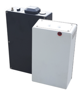
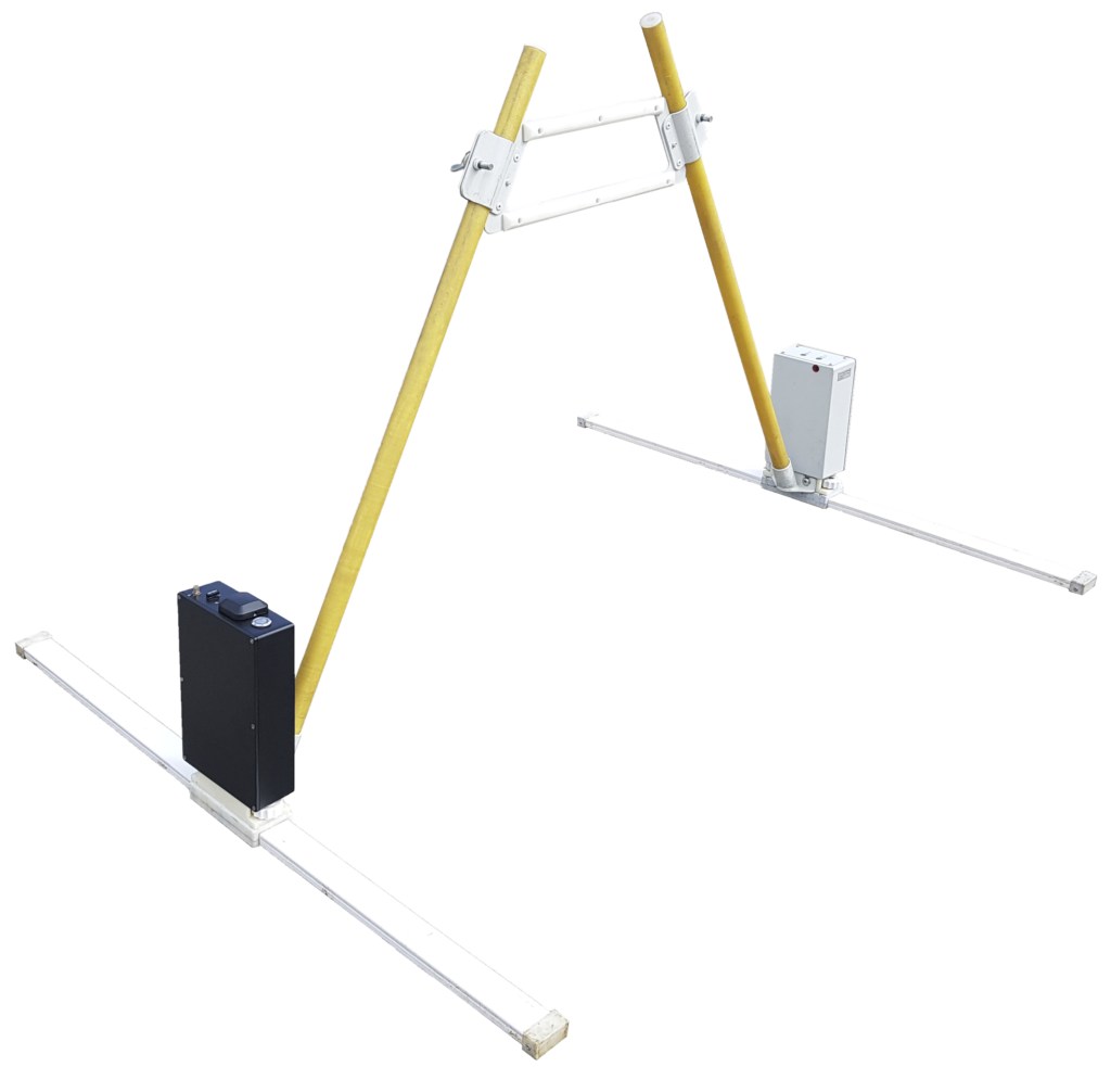
The device is mobile and compact: dimensions (no more than) 22.2 x 14.6 x 5.5 cm x 2. These are 2 small devices of similar size - a Receiver and a Transmitter. Excluding antennas and transport platform, the weight is 2.4 kg only.
Operating principle
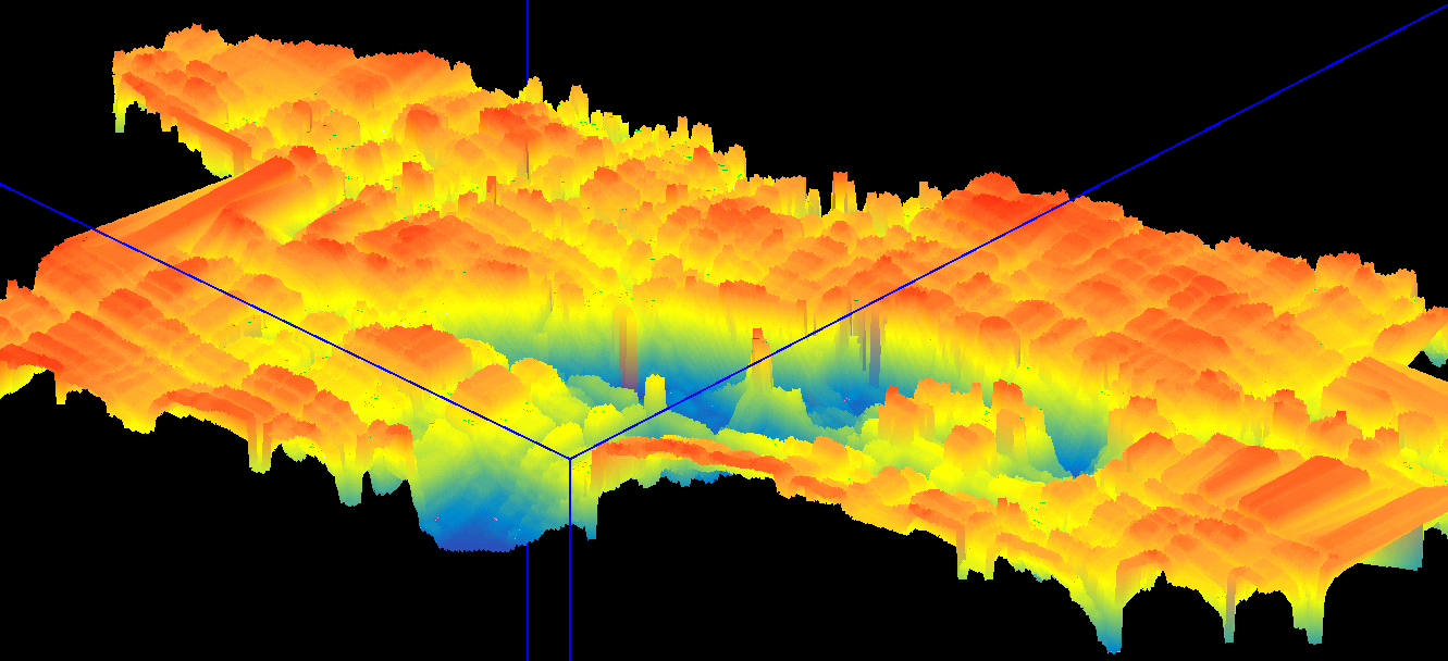
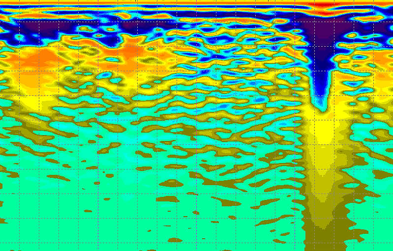 GEORA X20 directs probing pulses into the investigated medium (water, earth, walls of buildings, etc.). The emitted electromagnetic pulse is reflected from the boundary of layers, metallic, non-metallic objects and inhomogeneities (voids, areas with different humidity, etc.). The reflected electromagnetic signal is received by the antenna unit, converted into digital form and stored in a memory device for further processing, which allows you to see 3D structures under the surface of the earth, water, concrete, etc.
Up to 100 meters underground there are
foundations and communications, the modern cultural layer and the remains of ancient cultures, geological formations that could pose a danger to human life on the surface or, conversely, bearing benefits, Quaternary sediments containing most of the minerals. Therefore, the ability to view the subsoil is very important for many spheres of life. Most modern georadars scan up to 25 m in the bowels of the earth.

GEORA X20 GPR can be used for: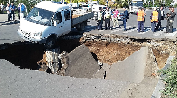
- Geological exploration and mineral exploration
- Archaeological research
- Control of technologies for the construction of roads, bridges, buildings (for example, determining the thickness and uniformity of the layer of asphalt, crushed stone, sand, wall and foundation thicknesses)
- Work to prevent man-made and natural disasters (for example, determining the destruction in the foundation of the road base, determining the places of undermining of roads and structures to prevent their failure; research of glaciers to prevent avalanches, etc.)
- Construction and forensic expertise
- Search for sunken objects and underwater geological structures
When developing this device, we set ourselves the goal
to increase the availability and quality of sounding of underground and underwater bowels, while reducing the cost of geological exploration in comparison with other instruments on the world market. At the moment, the exploration of subsoil at great depths is a complex of very expensive works. The georadar GEORA X20 is easy to operate, does not require a large number of personnel and their special training, reduces expedition costs, in general, it is designed to reduce the research budget for various public and private needs.
The device has a user-friendly interface with flexible settings that allow you to change the depth, resolution (density) and other sounding parameters. Currently, software is being developed that allows you to build not only linear, but also three-dimensional images directly in the process of shooting.
Specifications and equipment:
 Frequency range (MHz) 1-1000
- The frequency of probing pulses is up to 1000 pulses per second (at the maximum pulse frequency when moving at a speed of 36 km/h, the measurement interval will be 10 mm)
- Pulse type: Broadband video pulse, without carrier frequency
- Pulse power 2-200 MW
- Pulse duration 1 nsec
- Receiver: 2GSPS sampling rate (0.5 nsec)
- 16-bit ADC registration mode
- Switchable logarithmic or time-variable amplifier (linear)
- Dynamic range variable from 0 to 120 dB
- Time scans (number of samples in one sounding signal) 16000
- Dynamically tunable input filters
- Interference suppression
- Automatic synchronization with the Transmitter
- Built-in memory 128 GB
- Additional sensors: barometer, accelerometer (measuring the angle of inclination of the device), GPS, built-in local navigation system
- Control by buttons on the device or via wi-fi from any device. There is a web interface, a PC program, a mobile application
- Operating time from the built-in battery is 6 hours, it is possible to connect an external battery pack (+24 hours)
- Built-in test signal generator
- Overall dimensions 222 x 146 x 55 mm (x 2)
- Weight 2.4 kg
- Tested operating speed of the GPR up to 40 km/h

The device is supplied with a set of antennas with a central frequency of 100MHz (1.5 m), 200MHz (1m), 400 MHz (0.5 m). Additionally, you can purchase low-frequency antennas for deep sounding of 10MHz ( 10m), 25MHz (6m), 50MHz (3m) (in parentheses, the size of the antennas, not the depth of the sensing). By increasing the length of the antennas, we increase the depth of sounding. It is important to note that the depth of sounding also depends on the power of the transmitter and on the density/properties of the soil. So on sandy soils, the range of the wave passage increases several times in comparison with loam. Thus, by increasing the power of the transmitter and lowering the frequency of the antennas, we can increase the depth of sounding up to hundreds of meters.
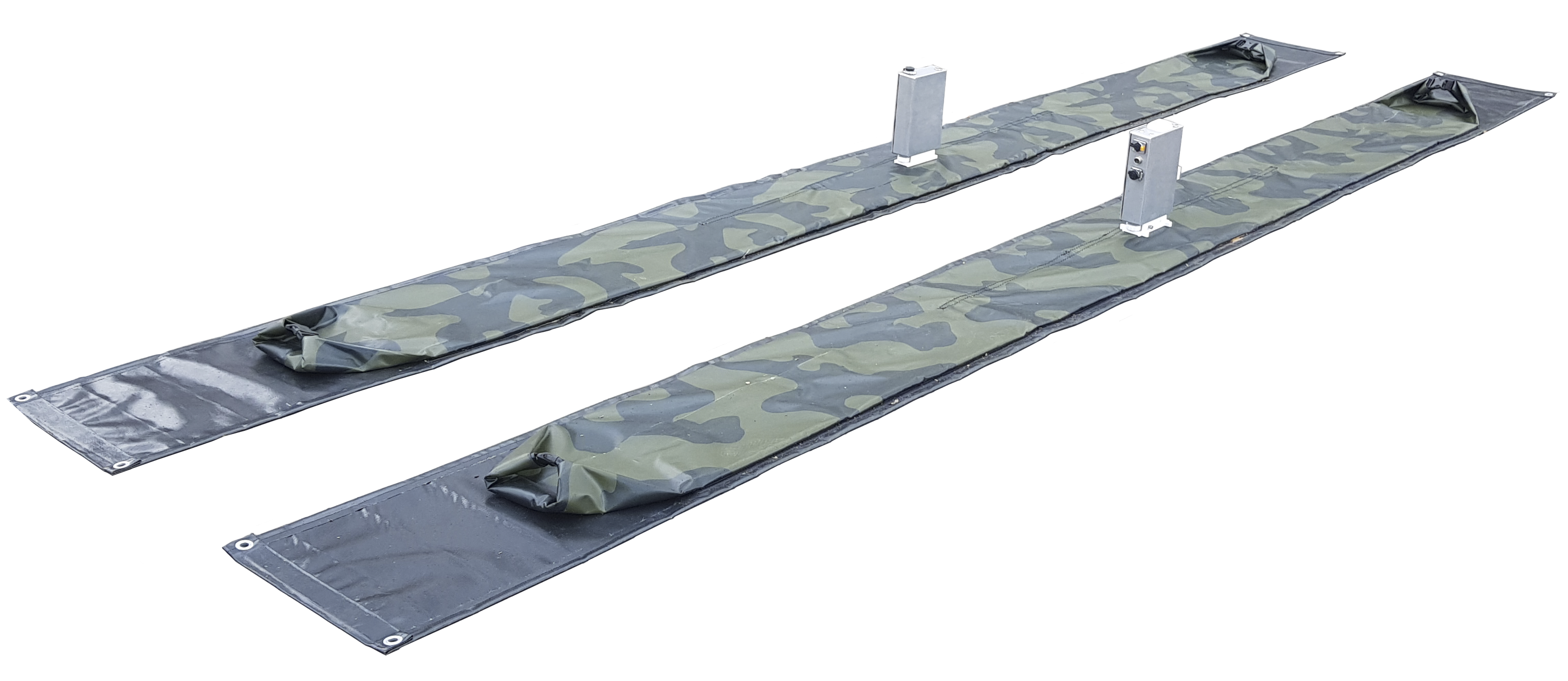
The GEORA X20 is supplied with a lightweight modular platform for manual handling by default. Additionally, you can purchase a wheeled platform (it can also be moved manually or attached to vehicles up to 40 km/h), inflatable structures for working on water.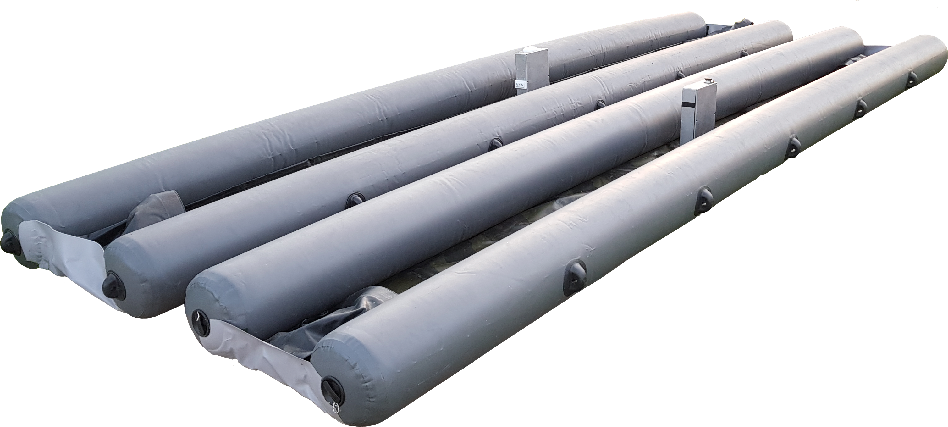
For comparison, we present the indicators of the NASA ground-penetrating radar, which was sent to Mars to study the subsurface:
Tech Specs
- Main Job - to see geologic features under the surface with ground-penetrating radarLocation The radar antenna is on the lower rear of the rover
- Mass - less than 6.6 pounds (3 kilograms)
- Power 5 to 10 watts
- Volume by 4.7 by 2.4 inches (196 x 120 x 66 millimeters)
- Data Return 5 to 10 kilobytes per sounding location
- Frequency Range 150 to 1200 megahertz
- Vertical Resolution As small as about 3 to 12 inches thick (15 to 30 centimeters) thick
- Penetration Depth Greater than 30 feet (10 meters) deep depending on materials
- Measurement Interval About every 4 inches (10 centimeters) along the rover track
Thus, the most significant indicators - the depth and the interval (density) of measurements - in the GEORA X20 GPR are an order of magnitude higher.